Category Archives: Floods

Flood: Beyond Risk Transfer

Half a billion people worldwide are affected by floods annually, and about 90 percent of all U.S. natural disasters involve flooding. The human and economic tolls are massive, and until recently insuring these risks and helping communities recover fell almost entirely on government programs. 

Improved data, analysis, and modeling have helped drive private-sector interest in flood-risk transfer and mitigation. But despite growing private involvement, many experts consider the current system unsustainable. A resilience mindset is required, and that demands more than insurance products.

A new Triple-I paper analyzes the current state of flood risk and resilience and discusses how governments, corporations, academia, and others are rising to the challenges and seizing the opportunities.

“New products alone will not close the protection gap,” says Triple-I CEO Sean Kevelighan. “Risk transfer is just one tool in the resilience toolkit. Our understanding of loss trends and expertise in assessing and quantifying risk must be joined at the hip to technology, public policy and finance, and science. We need to partner with communities and businesses at every level to promote a broad resilience mindset focused on pre-emptive mitigation and rapid recovery.”

The Triple-I paper describes how this is happening. Tapping its own resources and the expertise of its insurance and risk-management network, Triple-I is pleased to bring you this analysis of the current state of flood risk and resilience.

Partnering to Improve Flood Resilience

Improved access to data, analytical tools, and sophisticated modeling capabilities has turned flood insurance from a virtually untouchable risk for insurers to an area of increasing business opportunity. These developments also have put the pieces in place for powerful collaborations between corporations, governments, and nonprofits to drive flood resilience for communities and businesses.

Stormwater management is one example. Triple-I CEO Sean Kevelighan recently participated in a panel at the P3 Water Summit to discuss flooding and water quality challenges and how insurers, municipalities, rating agencies, and other entities are incorporating flood and climate risks into their businesses.

The view from the middle

“Insurance is in the middle of all of this,” Kevelighan said, referring to three major global crises the moderator had mentioned – biodiversity loss, climate change, and the COVID-19 pandemic – “and I might add geopolitical risk and social unrest, as well as disruption due to technology and innovation. Triple-I is here to inform all those discussions.”

Climate risk, he said, “is certainly on the forefront of all the discussions we’re having right now, in terms of the larger disruption continuum.”

For decades, he noted, the industry has been looking for ways not just to help customers recover from natural catastrophes but to get out in front of the risks and promote methods to make them more resilient.

Flooding is a particularly pressing risk, Kevelighan noted, because “every year you’ve got about a half billion people who are impacted by floods. About 90 percent of all U.S. natural catastrophes involve some form of flooding. This is a critical part of the catastrophe cycle – and one that is significantly underinsured.”

Flood insurance and recovery assistance historically have fallen to federal and state government to manage. But even as improved data and other capabilities have made writing the coverage an increasingly attractive opportunity for insurers, Kevelighan said, it also has become clear that risk transfer through insurance isn’t enough to close the “protection gap.”  Public-private partnerships and other approaches are essential.

Bringing it all together

Richard Seline, managing director of Resilient H2O Partners and co-founder of the Resilience Innovation Hub, talked about his companies’ efforts to “introduce emerging technologies, existing equipment, put it together with public and private interests” to promote activities and behaviors supportive of resilience.

“The Innovation Hub is intended to bring together the best ideas, the best experience, the best capital, and network it more efficiently and effectively,” Seline said. “We’re in lots of discussions with engineering firms, architecture firms, a lot of private equity firms. I didn’t know until a year ago that the Nature Conservancy has its own venture fund! Those are the types of folks we’re pulling together.”

Like Kevelighan, Seline pointed to the importance of data in making these collaborations possible: “Unless we have the data available to do the cost-benefit analysis and the return on investment, it’s all theoretical.”

Thanks to partnerships between organizations like Triple-I and Resilient H2O, he said, it’s now possible to marry hydrological data to financial and economic risk models to better inform investment planning and decision making.

Ready to ‘take off’

Stacey Mawson, director at Fitch Ratings, said the environment now seems ripe for stormwater public-private partnerships to “take off.”

“Over the past couple of years we’ve been seeing more projects coming to us for ratings,” she said. These have included water transport, flood mitigation, privatization of utilities because they need additional investment. “We’re seeing an increased focus on water in all its aspects.”

Companies that issue bonds and other forms of debt rely on rating agencies’ assessments of their creditworthiness to keep their borrowing costs low. A bad rating may cause bond buyers to demand a higher interest rate in return for the greater risk such a rating implies.

Rating agencies like Fitch can play a strong role in advancing environmental and social objectives by incorporating climate and social risks into their rating processes. Mawson discussed Fitch’s environmental, social, and governance (ESG) scores and suggested that, over time, if bond-issuing entities aren’t paying sufficient attention to such considerations it could become a rating issue.

For more information and insight on flood risk, check out our new research paper, Flood: Beyond Risk Transfer.

Polar Vortex,Convective StormsKeep Driving Losses

Insured losses from March storms in the United States are likely to surpass $1 billion, Aon said in its monthly Global Catastrophe Recap.

Aon said multiple outbreaks – featuring tornadoes, hail, snow, and flooding – were to blame.  The most notable included severe weather across the Central and Southern United States, with 122 tornadoes touching down during the month – the most since 2017. Alabama, Mississippi, Texas, Georgia, and Tennessee experienced the most damage.

This followed record-setting winter weather-related insured losses in February, following a prolonged Polar Vortex event, in which Arkansas, Kentucky, Tennessee, and Texas were among the hardest-hit states.

“The Polar Vortex generated record-breaking cold temperatures which extended as far south as the U.S./Mexico border,” Aon said in its February report. “Concurrently, a series of low-pressure systems produced rounds of hazardous snow, sleet, freezing rain, ice, and severe thunderstorms with impacts spanning from Washington state to the Mid-Atlantic.”

Texas was hard hit by the winter weather, which left dozens dead, millions without power, and nearly 15 million with water issues and could wind up being the costliest disaster in state history. Disaster-modeling firm AIR Worldwide says insured losses “appear likely to exceed $10 billion.”

The Electric Reliability Council of Texas (ERCOT) has been widely criticized for failing to require power facilities to be winterized after the last major storm that caused outages in 2011, thus contributing to damage incurred during the more recent one. Last week, the Cincinnati Insurance Company, headquartered in Ohio, filed suit asking a federal court for a declaratory judgment that would allow the insurer to decline paying damages in bodily injury or property damage lawsuits where ERCOT is found to be liable.

If the federal court doesn’t grant the declaratory judgment, Cincinnati Insurance would likely have to cover ERCOT under its current policy contract.

In February and into March, multiple rounds of heavy rainfall and severe weather generated flooding across parts of the Ohio and Tennessee Valleys. Parts of Kentucky, Tennessee, and West Virginia were most affected.

“Impacts were compounded by localized severe weather, including large hail, straight-line winds, and isolated tornadoes,” Aon reported. “Total economic losses were estimated to approach USD 100 million.”

A large portion of the residential flood damage was expected to be uninsured due to low National Flood Insurance Program (NFIP) coverage.

Severe weather activity in the South continues in April. A cluster of storms swept across the region over the weekend, leaving one person dead in Louisiana, toppling trees and power lines in Mississippi, dropping baseball-sized hail in Alabama, and leveling buildings in the Florida Panhandle.

FEMA’s New Approach to Flood Risk Will Make Insurance Program Fairer

The Federal Emergency Management Agency (FEMA) last week unveiled details of Risk Rating 2.0 – its plan to modernize the National Flood Insurance Program (NFIP) to make it fairer and more sustainable.

The changes measuring flood danger differently – gauging properties’ specific risks and replacement costs, rather than simply whether they sit in a FEMA-designated “flood zone.”  FEMA officials said this would end a system in which low-value homes effectively subsidize insurance for high-value homes.

Despite concerns that Risk Rating 2.0 would lead to huge premium increases, NFIP Senior Executive David Maurstad said 23 percent of policyholders will see “immediate decreases,” 66 percent will see an “average of zero to $10 a month” in additional premiums, and 11% will pay higher bills, some more than $20 a month.

NFIP owes the U.S. Treasury $20.5 billion after a series of hurricanes that resulted in claims costs greater than the premiums FEMA received.

“Our current system is just fundamentally not working for us anymore,” Maurstad said, adding that the new approach would result in a “more equitable, accurate and individualized NFIP.”

Lawmakers in coastal states like Florida worried about the sudden impact of higher rates – more accurately reflecting the greater flood risk in those areas – on their constituents.  FEMA has ameliorated those concerns by making new rates apply only to new policies when the program takes effect in October 2021. Homeowners and businesses with existing flood policies won’t see a rate change until April 2022.

FEMA said high-value homes in high-risk areas would experience seeing the largest increases. FEMA expects their rate increases would take effect over a 10-15 year “glide path” as they continue to be protected by an 18 percent annual cap on premium increases that is written into law.

The Union of Concerned Scientists (UCS) quickly weighed in on the plan.

“The system we’ve used to calculate flood risk, and in turn insurance policy premiums, no longer holds water,” said Shana Udvardy, a UCS climate resilience analyst. “Outdated maps have left homeowners ill-prepared for possible disasters. Risk Rating 2.0 could go a long way in helping homeowners better understand their risk, ensuring they can make informed decisions to protect themselves and their property.”

“It is great to see that FEMA is moving forward with Risk Rating 2.0, which is so badly needed,” said Matthew Eby, executive director of the First Street Foundation, a climate and technology non-profit that has done its own extensive flood-mapping. A recent First Street analysis found the United States to be woefully underprepared for damaging floods.

It identified “around 1.7 times the number of properties as having substantial risk,” compared with FEMA’s flood zone designation. “This equates to a total of 14.6 million properties across the country at substantial risk, of which 5.9 million property owners are currently unaware of or underestimating the risk they face.”

Floods, Freezing, Other Extreme Weather Highlight Need for Planning and Insurance

Recent flooding in Kentucky “is going to be one that goes into the record books,” the state’s Emergency Management Director Michael Dossett said in a news conference this week. At least 49 counties had issued disaster declarations following days of rain that dumped four to seven inches across a wide stretch of the state and pushed rivers to levels not seen for decades.

Dossett and Gov. Andy Beshear said the state had been in contact with the Federal Emergency Management Agency (FEMA) to seek federal aid and that assessments would be made next week for both the flooding and an ice storm last week. Damage assessments for the ice storm had been put on hold by the floods.

Extreme weather events, like these floods and last month’s winter storm that left dozens of Texans dead, millions without power, and nearly 15 million with water issues, underscore the importance of resilience planning and of homeowners and businesses having appropriate insurance coverage.

Flood protection gap

About 90 percent of all U.S. natural disasters involve flooding.  Whether related to coastal and inland inundations due to hurricanes, extreme rainfall, snowmelt, mudflows, or other events, floods cause billions of dollars in losses each year. According to FEMA, one inch of flood water can cause as much as $25,000 in damage to a home.

But direct economic losses are only part of the picture. Human costs are enormous, and it can take families, businesses, and communities years to recover.

Flood damage is excluded from coverage under standard homeowners and renters insurance policies. However, coverage is available from the National Flood Insurance Program (NFIP) and from a growing number of private insurers.

Many people believe they don’t need flood insurance if the bank providing their mortgage doesn’t require it; others assume their homeowners insurance covers flood damage; others think they cannot afford it.

As a result, a substantial protection gap exists.

A recent analysis by the nonprofit First Street Foundation found the United States to be woefully underprepared for damaging floods. It identified “around 1.7 times the number of properties as having substantial risk,” compared with FEMA’s flood zone designation.

“This equates to a total of 14.6 million properties across the country at substantial risk, of which 5.9 million property owners are currently unaware of or underestimating the risk they face,” the report said.

Current system unsustainable

The NFIP owes more than $20.5 billion to the U.S. Treasury, leaving $9.9 billion in borrowing authority from a $30.43 billion limit in law. This debt is serviced by the NFIP and interest is paid through premium revenues. With flood losses on the rise, the current system is not sustainable without changes.

In December, FEMA proposed “substantively” revising the “estimated cost of assistance” factor the agency uses to review governors’ requests for a federal disaster declaration to “more accurately assess the disaster response capabilities” of the states, District of Columbia and U.S. territories. Its Risk Rating 2.0 initiative, set for implementation in October, aims to make flood insurance rates more accurately reflect insured properties’ individual flood risk.

 In other words, the federal government will likely ask states, municipalities, and some policyholders to shoulder more of the cost of recovering from natural catastrophes.

Complex challenges require multi-pronged approaches to address them, and FEMA and other federal and state agencies are working with the private sector to close the flood protection gap. In the near term, the most cost-effective way for families and businesses to mitigate flood risk is insurance.

If it can rain where you are, it can flood where you are. As Daniel Kaniewski, managing director for public sector innovation at Marsh & McLennan and former deputy administrator for resilience at FEMA, put it during a Triple-I webinar last year: “Any home can flood. Even if you’re well outside a floodplain, get flood insurance. Whether you’re a homeowner or a renter or a businessowner — get flood insurance.”

Study Quantifies Future Climate Change Impact on Flood Losses

A new study from the nonprofit First Street Foundation projects the impact climate change may have on U.S. flood losses.

The report – The Cost of Climate: America’s Growing Flood Risk –finds that, when adjusting for the long-term impact of a changing climate, nearly 4.3 million homes have “substantial” flood risk that would result in financial loss.

“If all of these homes were to insure against flood risk through the National Flood Insurance Program (NFIP),” the report continues, “the rates would need to increase 4.5 times to cover the estimated risk in 2021, and 7.2 times to cover the growing risk by 2051.”

Last year, the foundation released a report indicating that nearly 6 million U.S. properties could be at greater risk of flooding than currently indicated by Federal Emergency Management Agency (FEMA) flood maps.

The new report is particularly resonant as FEMA prepares to implement Risk Rating 2.0, an initiative to make flood insurance pricing more representative of each policyholder’s exposure and help customers better understand their risks and the importance of having flood coverage. It plans to accomplish this by using industry best practices and technology to deliver rates that “are fair, make sense, are easier to understand, and better reflect a property’s unique flood risk.

Implementation of Risk Rating 2.0 is scheduled to begin in October 2021.

Since homeowners who have federally backed mortgages and reside in FEMA-designated Special Flood Hazard Areas (SFHA) are required to buy flood insurance, the First Street data serve as an example of an early indicator of who could be most affected by risk-based rate changes in the near term and as the impacts of climate change evolve.

Potential cost consequences of expanded coverage under NFIP – or, worse, of not addressing the existing flood-protection gap – underscore the importance of a multi-pronged approach to mitigation and resilience that includes improved attention to how, where, and whether to build or rebuild and expanded availability and affordability of insurance.  

Study Supports Casefor Flood Mitigationas World Warms

Intensifying rainfall fueled by climate change over the past 30 years has caused nearly $75 billion in flood damage in the United States, according to a study by Stanford University researchers.

The findings, published in the journal Proceedings of the National Academy of Sciences, shed light on the growing costs of flooding and the heightened risk faced by homeowners, builders, banks and insurers as the planet warms. Losses resulting from worsening extreme rains comprised nearly one-third of the total financial cost from flooding in the U.S. between 1988 and 2017, according to the report, which analyzed climate and socioeconomic data to quantify the relationship between changing historical rainfall trends and historical flood costs.

About 90 percent of natural disasters in the United States involve flooding, and much has been written about the flood protection gap.

“On average nationwide, only 30 percent of homes in the highest risk areas have flood coverage,” according to the Risk Management and Decision Processes Center of the Wharton School at the University of Pennsylvania, a Triple-I Resilience Accelerator partner. “Less than 25 percent of the buildings flooded by Hurricanes Harvey, Sandy, and Irma had insurance. Indeed, repeatedly after floods there is evidence of the United States’ large and persistent flood insurance gap.”

To make matters worse, a recent analysis by the nonprofit First Street Foundation found the United States to be woefully underprepared for damaging floods. The foundation identifies “around 1.7 times the number of properties as having substantial risk,” compared with Federal Emergency Management Agency (FEMA) flood designation.

Flood coverage isn’t included in most homeowners insurance policies, so many may not know they don’t have it if their bank didn’t require them to buy it before providing a mortgage. Until recently, flood insurance was considered an untouchable risk for private insurers to write, so FEMA’s National Flood Insurance Program (NFIP) was the only game in town.

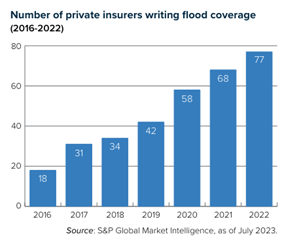
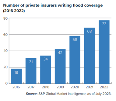
In recent years, however, Congress adopted new laws to support the emergence of a robust domestic private flood insurance market.  Last year, regulators provided rules that allowed private carriers to offer flood policies outside of NFIP and to qualify for the mortgage flood insurance requirement. Carriers and reinsurers are expanding their use of sophisticated models to underwrite flood risk, driving the growth of private sector flood insurance.

Triple-I has more information about flood insurance in our Spotlight on: Flood insurance article.

Expanded Triple-I Flood Risk Maps Provide Richer Perspective

The Triple-I Resilience Accelerator’s flood risk visualization tool is being enhanced with:

  • National Flood Insurance Program (NFIP) data on “take-up rates” by U.S. county from 2010 to 2021,
  • Differences between take-up rates inside and outside of flood zones, and in different proximities to flood zones.

These additions will expand the Accelerator’s visualization from covering only the current year to providing an historical perspective on how take-up rates have changed over time. 

Take-up rates and resilience

Insurance take-up rates represent the percentage of people eligible for a particular coverage who take advantage of it. In the case of flood insurance, they are calculated as the number of insurance policies in force in a certain geography over the total number of eligible properties for which insurance can be bought.

Understanding flood insurance take-up rates is essential to assessing and improving communities’ ability to rebound from damaging events. About 90 percent of natural disasters in the United States involve flooding, the NFIP says, and much has been written about the flood protection gap.

“On average nationwide, only 30 percent of homes in the highest risk areas have flood coverage,” according to the Risk Management and Decision Processes Center of the Wharton School at the University of Pennsylvania, a Triple-I Resilience Accelerator partner. “Less than 25 percent of the buildings flooded by Hurricanes Harvey, Sandy, and Irma had insurance. Indeed, repeatedly after floods there is evidence of the United States’ large and persistent flood insurance gap.”

But understanding that gap to a degree that will support meaningful action requires comprehensive, granular data only NFIP can provide. It also requires the data to be available in easy-to-use formats. This is where the Triple-I/NFIP collaboration comes into play.

Key considerations to keep in mind when looking at take-up rates are year-over-year changes; whether the rates are by city, county, or state; and whether they are for all homes or homes in flood zones alone. During the first quarter of 2021, Triple-I’s Resilience Accelerator’s flood map will be updated with four options for users to visualize:

  • Annual take-up rates from 2010 to 2018,
  • 2019 take-up rates based on 2018 renewals only,
  • County-wide and flood-zones-only take-up rates estimates for 2020, and
  • County-wide share of dwellings in close proximity to flood zones.

Historical perspective

In 2019, NFIP started publishing historical data on NFIP insurance coverage, policies, and claims. NFIP’s decision to publish this data was a transformative point for industry practitioners, academics and those involved with flood insurance analysis. The Triple-I’s visualizations use NFIP’s full- and part-year data from 2010 to 2019 and our own estimates, based on this data, for 2020.

Dr. Michel Léonard, CBE, Triple-I vice president and senior economist says: “We’ve worked closely with NFIP to ensure that our visualizations reflect the most current, accurate information available on flood insurance take-up rates. In addition, we wanted to add to the discussion surrounding NFIP take-up rates by providing less common yet insightful ways to understand and visualize take-up rates, such as take-up rates for properties in flood zones only or the share of a country’s property in different proximities to flood zones.”

Flood coverage, as opposed to water damage from mechanical breakdown inside a house, isn’t included in most homeowners insurance policies, so many homeowners may not realize they don’t have it if their bank didn’t require them to buy it before providing a mortgage. Until recently, flood insurance was considered an “untouchable” risk for private insurers to write, so the NFIP was the only game in town.

In recent years, however, Congress adopted new laws to support the emergence of a robust domestic private flood insurance market.  Last year, regulators provided rules that allowed private carriers to offer flood policies outside of NFIP and to qualify for the mortgage flood insurance requirement. Carriers and reinsurers are expanding their use of sophisticated models to underwrite flood risk, driving the growth of private sector flood insurance.

 “We want to acknowledge and stress how significant the NFIP Policy and Claims data is to increasing our understanding of flood risk,” Léonard said. “Good data takes a lot of work, and NFIP’s commitment to making this data available is a perfect example of public-private partnerships delivering concrete value.”  

Mangrove Insurance: Parametric + Indemnity May Aid Coastal Resilience

Earlier this year, I wrote about the role mangrove forests and coral reefs play in mitigating tropical storm damage and how insurance might help protect these critical resources. A recent Nature Conservancy study looks specifically at opportunities in mangrove protection and restoration and identifies where insurance could be used to support their resilience benefits.

In many places, mangroves are the first line of defense, their aerial roots helping to reduce erosion and dissipate storm surge. In Florida, one study found, mangroves alone prevented $1.5 billion in direct flood damages and protected over half a million people during Hurricane Irma in 2017, reducing damages by nearly 25% in counties with mangroves. Another study found mangroves actively prevent more than $65 billion in property damage and protect over 15 million people every year worldwide.  

Unfortunately, they frequently fall victim to development that creates the greatest potential for storm-related losses.

The Nature Conservancy study describes the implementation of a coral reef insurance product in Quintana Roo, Mexico, and explores how the model could be adapted for mangrove preservation. In Quintana Roo, a trust fund accepts money from public, private and philanthropic sources, as well as a federal fee collected from beachfront property owners who wish to use the beach for commercial purposes. It uses those funds to buy the insurance – a parametric product that is triggered if wind speeds in a designated area exceed 100 knots.

Parametric policies cover risks without the complications of sending adjusters to assess damage after a catastrophe. Instead of paying for damage that has occurred, it pays out if certain agreed-upon conditions are met – for example, a specific wind speed or earthquake magnitude in a particular area. If coverage is triggered, a payment is made, regardless of damage. Speed of payment and reduced administration costs can ease the burden on both insurers and policyholders.

“Unlike coral reefs, however, mangroves do not usually require rapid post-storm interventions in order to survive,” the study says. This means an indemnity insurance policy might be created that delivers payments based on post-catastrophe assessments of mangrove damage. “There are a variety of insurance products available that can be tailored to meet the specific needs of mangroves, with initial payouts made quickly through parametric covers and assessed payouts made through indemnity cover at a later stage.”

Before a mangrove insurance policy can be developed and deployed, a full feasibility study would need to be conducted.  The Nature Conservancy report recommends that this include “higher-resolution flood-risk models, estimation of the wind-reduction benefits of mangroves, and the construction of fragility curves to show the relationship between damage to a mangrove forest and some component of a storm event, such as storm surge or wind speed.”